Homeowner’s guide to Bushfire Attack Levels and how to check yours
If your home (or the home you’re planning to build) is near bushland, grassland, or coastal scrub, you’ve probably heard the term “BAL”. BAL stands for Bushfire Attack Level — a construction rating used across Australia to help determine how a building should be designed and built in bushfire‑prone areas.
Knowing your BAL can help you plan renovations, understand approval requirements, and choose building components that are suitable for the level of bushfire exposure expected at your site.
Important: This article is general information only. BAL results and construction requirements should always be confirmed with your local council and/or a qualified building certifier or bushfire consultant.
What is a BAL?
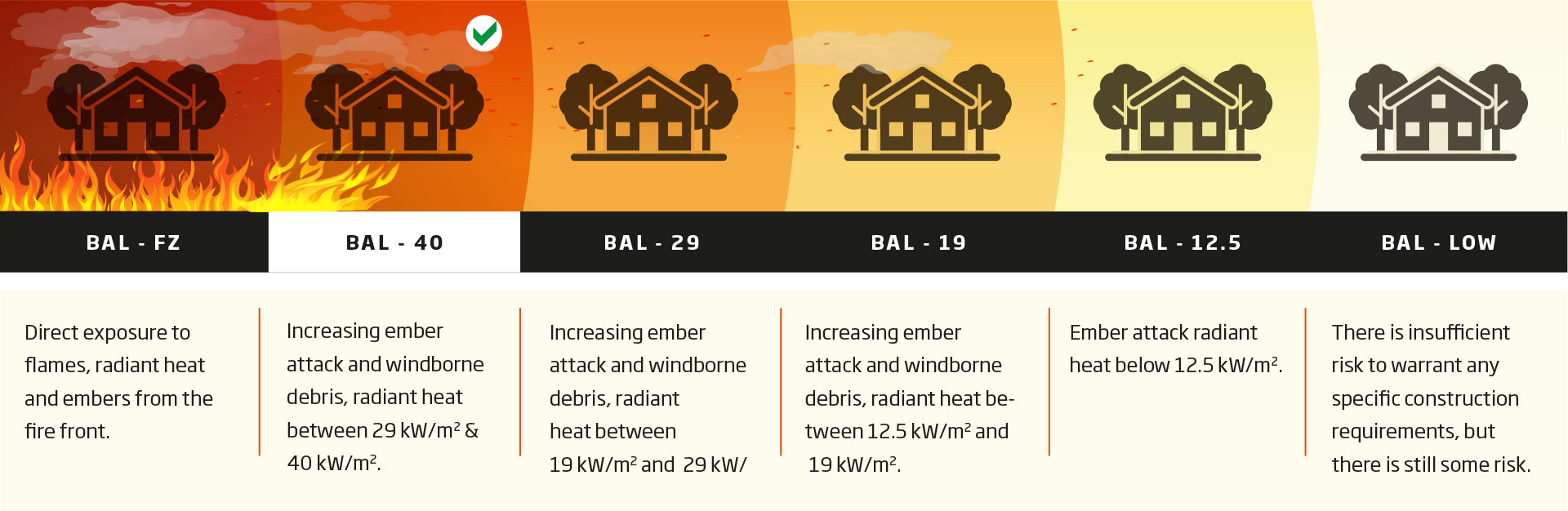
A Bushfire Attack Level (BAL) is a way of measuring the severity of a building’s potential exposure to three main formsof bushfire attack:
- ember attack (wind‑blown burning debris)
- radiant heat (heat you feel from a fire, which can crack windows and ignite surfaces)
- direct flame contact (when flames reach the building).
BAL ratings form part of the national construction approach under Australian Standard AS 3959 (Construction of buildings in bushfire‑prone areas). Depending on where you live, a BAL assessment may be required for building permits, planning permits, or both.
Quick clarification: BAL is not the same as bushfire warnings or fire danger ratings issued during a bushfire season. BAL is about building design and compliance.
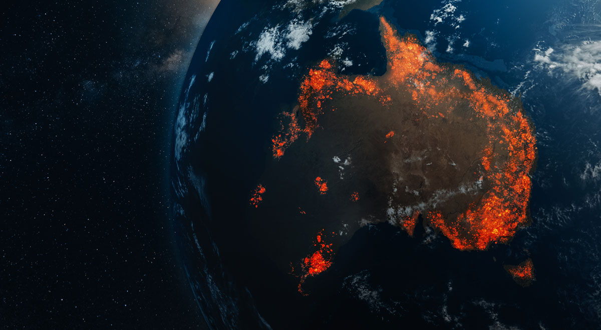
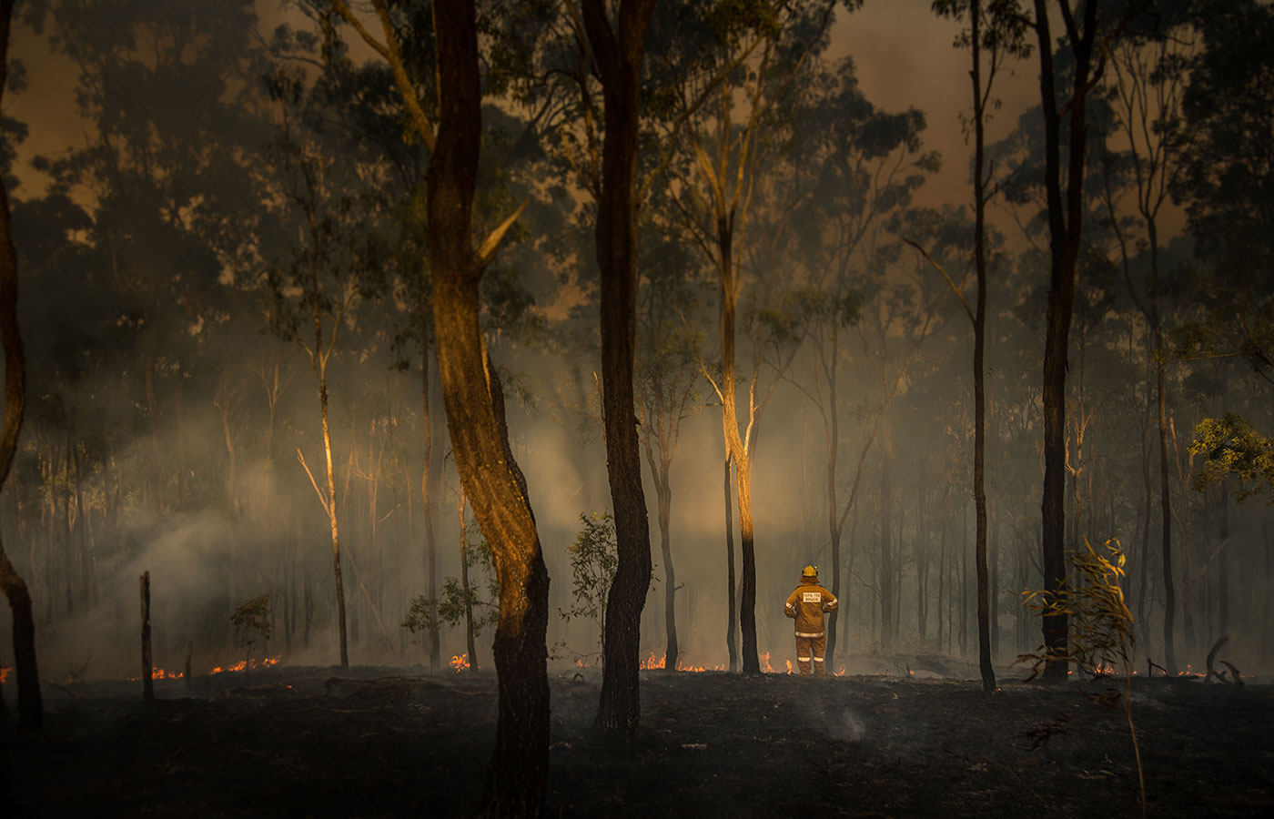
How bushfires can impact your home
Bushfire planning isn’t only about the fire front. Embers can be carried by wind and land on (or in) buildings, igniting vulnerable points such as roofs, vents, decks, gutters and leaf litter around the home.
Ember attack is widely recognised as the most common way houses catch fire during a bushfire. Embers can travel kilometres ahead of the fire front, and the risk is typically highest close to the fire.
BAL levels explained
There are six BAL categories, ranging from lower exposure through to Flame Zone (FZ). The higher the BAL, the greater the construction requirements.
How is a BAL determined?
A formal BAL assessment is usually prepared by a suitably qualified professional. The assessment method set out in AS 3959 considers the landscape and bushfire conditions around a proposed building site, including:
- the local fire danger index used for design purposes
- the type of surrounding vegetation (for example, forest, woodland, shrub land or grassland)
- how close that vegetation is to the building site
- the slope of the land under the vegetation (fires burn faster up hill).
If you’d like to understand the basics before speaking with a professional, CSIRO’s bushfire resources include an overview of BAL assessment, and there are tools available for early‑stage, indicative checks. Just remember: self‑assessments and online tools are typically indicative — your certifier may still require a formal BAL report for approvals.
Useful national tools (for learning and indicative checks)
If you want to understand what goes into a BAL assessment, these tools can help with education and early planning:
- CSIRO bushfire best practice guide – BAL assessment tutorial
- BAL assessment tool (indicative)
How to check your BAL rating in each Australian state and territory
The process varies a little by location, but it usually follows the same pattern:
- Check whether your property is in a designated bushfire‑prone are a using your state/territory mapping tool.
- If you’re planning building work, confirm requirements with yourlocal council and/or building certifier.
- Where required, obtain a BAL assessment from a qualified assessorand include it in your building documentation.
Victoria (VIC)
In Victoria, designated Bushfire Prone Areas (BPA) and the Bushfire Management Overlay (BMO) can be viewed using VicPlan (the Victorian Government’s online mapping system).
To get started:
- Go to VicPlan and search your address.
- Turn on the Bushfire Prone Area (BPA) layer to see if your property is within a designated BPA.
- Turn on the Bushfire Management Overlay (BMO) layer to see if additional planning controls apply.
- If you’re in a BPA, a BAL assessment is typically part of the building permit process.
Helpful links:
- VicPlan (map)
- Victoria Planning – Building in designated bushfire prone areas
- Victoria Planning – Bushfire mapping and reviews
New South Wales (NSW)
In NSW, the NSW Rural Fire Service (NSWRFS) provides an online Bush Fire Prone Land (BFPL) mapping tool. It’s designed to identify whether your property is designated as bush fire prone.
To get started:
- Open the NSW RFS ‘Check if you’re in bush fire prone land’ page.
- Enter your address and run the check.
- If you’re planning development, confirm details with your council (for example, via a Section 10.7 PlanningCertificate) and seek expert advice as needed.
Helpful link:
Queensland (QLD)
Queensland Fire Department provides a postcode checker that shows the bushfire potential in a neighbourhood. It doesn’t show current fires or predict the chance of a fire starting — it’s an indication of potential based on local conditions such as vegetation and terrain.
To get started:
- Use the Queensland Fire Department postcode checker to view bushfire potential where you live (or where you’re planning to build).
- For building and renovation requirements, also check your local council planning scheme and speak with your building certifier about whether a BAL assessment is required for your project.
Helpful link:
South Australia (SA)
In South Australia, the Country Fire Service (CFS) recommends checking your Bushfire Hazard Rating through the Planning and Design Code portal. If your property is identified within a high bushfire hazard overlay, you may need a BAL assessment.
To get started:
- Visit the CFS ‘Planning & Building in bushfire areas’ page.
- Use the ‘What is the property address?’ link to check your bushfire hazard rating.
- If you’re in a high hazard overlay, arrange a BAL assessment and follow any development application guidance from your council/CFS.
Helpful link:
Tasmania (TAS)
The Tasmania Fire Service (TFS) has worked with local councils to map bushfire‑prone areas through planning scheme overlays. You can view these overlays online.
To get started:
- Check whether your property is in a bushfire‑prone area overlay using LIST map (Tasmania’s public mapping platform).
- You can also view bushfire‑prone areas and related natural hazard information via the ‘RiskReady’ website.
- If you’re unsure, contact your local council or the Tasmania Fire Service to confirm.
Helpful links:
Western Australia (WA)
In Western Australia, the Department of Fire and Emergency Services (DFES) publishes the Map of Bushfire Prone Areas, which identifies land with potential bushfire impact. Additional planning and building requirements may apply within designated areas.
To get started:
- Open the DFES Bushfire Prone Areas page and follow the link to the statewide map.
- If your land is shown a sbush fire prone, speak with your local government/building authority early toconfirm what requirements apply to your proposal.
Helpful link:
Northern Territory (NT)
BAL requirements can still apply in parts of the Northern Territory depending on location and the type of building workbeing undertaken. Because the pathway can vary, start by speaking with your local council and a building certifier about bushfire construction requirementsfor your property.
To get started:
- Contact your local council/building certifier to confirm whether bushfire construction standards apply to your site and what documentation is required.
- Use SecureNT to stay informed about local preparedness resources and official warnings during the bushfireseason.
Helpful link:
- SecureNT bushfire preparedness
Australian Capital Territory (ACT)
In the ACT, Access Canberra advises that if you are building on a block located in an area that has a BAL rating, construction must align with the requirements for the specified BAL under AS3959–2018.
To get started:
- Check whether you are in a Bushfire Prone Area using the ACTmapi Bushfire Prone Areas map.
- Refer to Access Canberra guidance and confirm your BAL and documentation requirements with the certifier appointed to your development.
Helpful links:
- Access Canberra – requirementsfor bushfire prone blocks (construction note)
- ACT Emergency Services Agency –Bushfires (includes ACTmapi link)
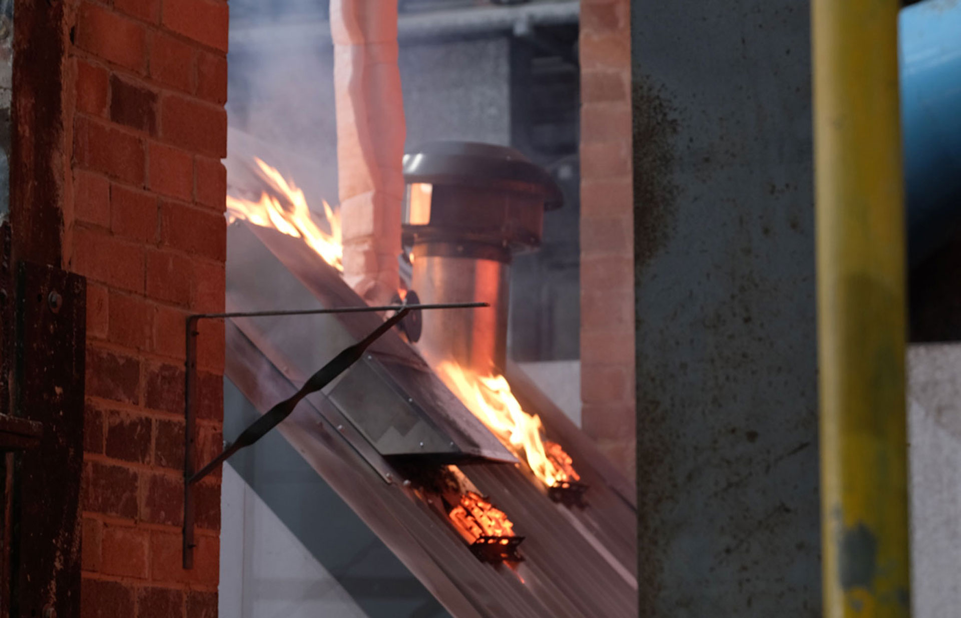
Schweigen IsoDrive® and BAL‑40
If you’re building or renovating in a higher BAL area, small details matter - including roof penetrations, vents and ducting pathways. These are common points where embers can enter roof spaces if they’re not properly designed and installed.
Schweigen’s IsoDrive® roof motor system has been bushfire tested in a BAL‑40 roof system by CSIRO Infrastructure Technologies. In CSIRO Test Report FSZ 2416 (conducted to AS 1530.8.1:2018), the tested IsoDrive® roof ventilator assemblies achieved a Bushfire Attack Level of AA40 (BAL‑40) for the purpose of building regulations in Australia.
Important: Always ensure products are installed in accordance with the manufacturer’s instructions and your project’s BAL requirements. Confirm the roof flashing is certified for the relevant BAL rating, and verify suitability with your building certifier.
- Check out "Always safer with a Schweigen" to lean more about Schweigen’s approach to safer, healthier homes.
- Architects, builders and specifiers may be interested to learn more in our Formal CPD titled, "Bushfire-Ready Ventilation: Compliance & Safety for Homes in Bushfire Zones" .
Final reminders
- BAL is a construction rating used for building design and compliance - it’s not an emergency warning level.
- Even if your property isn’t mapped as bushfire prone, you may still be exposed to smoke and embers depending on conditions.
- For any building work in a bushfire‑prone location, confirm approvals and requirements with your local council and building certifier.